A Water Quality Monitoring Program
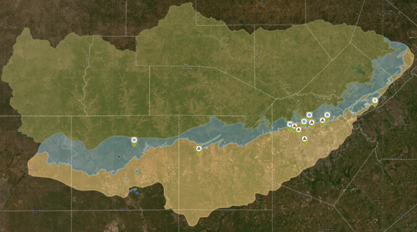
For over 10 years, the U.S. Geological Survey (USGS) has managed a cooperative program with SAWS to assess and evaluate conditions within the Edwards Aquifer Recharge Zone. This ongoing research program monitors and characterizes potential contaminants to the aquifer from urban and rural sources.
Surface water and groundwater quality is evaluated using both continuous monitoring and discrete sampling methods. Specific parameters of interest include nutrients, pesticides (such as herbicides), and personal care compounds like caffeine and pharmaceuticals. This collaborative study has evaluated groundwater residence time and age, hydrologic changes from drought to flood conditions, and surface water–groundwater interaction.
Through proactive monitoring of the Edwards Aquifer Recharge Zone, SAWS is safeguarding our primary potable water source.
For more information, visit the interactive map and data portal that has been created for this project:
US Geological Survey – Edwards Aquifer Urban Hydrology (usgs.gov)
Musgrove, M., Fahlquist, L., Stanton, G.P., Houston, N.A., and Lindgren, R.J., 2011, Hydrogeology, chemical characteristics, and water sources and pathways in the zone of contribution of a public-supply well in San Antonio, Texas: U.S. Geological Survey Scientific Investigations Report 2011–5146, 194 p., https://doi.org/10.3133/sir20115146.