About the Edwards Aquifer
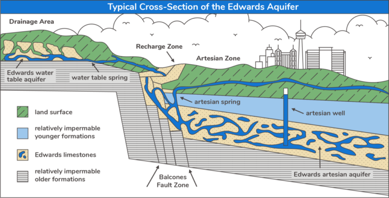
The Edwards Aquifer is intensely faulted and fractured carbonate limestone that lies within the Balcones fault zone. The dynamics and size of the this geologic anomaly make it one of the most wondrous aquifers in the nation, through its storage capacity, flow characteristics, water producing capabilities and efficient recharging ability.
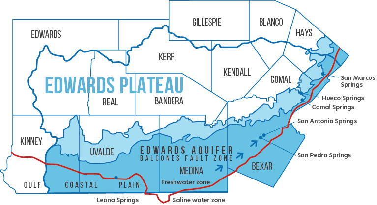
The Edwards Aquifer and its catchment area in the San Antonio region is about 8,000 square miles and includes all or part of 13 counties in south central Texas.
The recharge and artesian areas of the Edwards Aquifer underlie the six counties south and east of the Balconces fault escarpment. The aquifer underlies approximately 3,600 square miles, is about 180 miles long from west to east and varies from 5 to 30 miles wide. The Edwards Aquifer receives most of its water from the drainage basins located on the Edwards Plateau. The catchment area, about 4,400 square miles, contains the drainage basins of the streams that recharge the Edwards Aquifer.
Visit the Edwards Aquifer Authority website to learn more.